Services
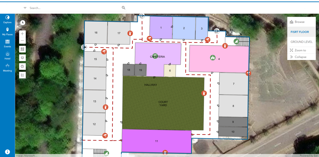
Indoor Mapping
Indoor Mapping is an extremely powerful tool that helps you manage your facilities and is an ideal technology for enhancing safety and security. We create digital representations of buildings interior spaces and structures by capturing and processing spatial data to provide accurate details about the layout, features, and navigation within indoor environments. Through various platforms including Esri ArcGIS Indoors, Map I.T. creates new CAD floor plans from LiDAR surveys or, converts existing PDF floor plans to modern CAD plans and converts them into digestible customized applications in a GIS environment. This solution is crucial for emergency response as well as general facility/asset management.
Data Collection
Map I.T. offers a variety of data collection services including GPS, conventional surveying, and LiDAR. Collectively, these data collection techniques contribute to the creation of comprehensive and reliable CAD, BIM and GIS datasets, facilitating informed decision-making and spatial analysis to solve organizational challenges and to drive business decisions. We are not only technology experts in data collection, but we make it our business to understand the big picture to ensure you get the most out of our deliverables. We always put the project in context and ensure we understand our clients’ goals with an eye on future enhancements that are right for you.
GIS
Map I.T. offers a wide range of GIS services. From simple 2D maps to complex 3D models and digital twins, we can offer top-of-the-line custom GIS solutions to solve your challenges. Whether for asset management, data visualization, record keeping, or operational enhancement, we have the solution for you. Our GIS experience includes BIM/GIS integration, CAD/GIS interoperability, digital twin development, custom GIS applications and more. We utilize the most advanced Esri technologies including ArcGIS Indoors and field mobility applications such as Field Maps and Survey123. Map I.T. is on the forefront of GIS, and we tailor our vast knowledge of solutions to fit your individual needs.
BIM Modeling
While 2D maps are great, the world we live in is 3D. Map I.T. creates 3D BIM models as the foundation of the Digital Twin, representing the real-world condition in the digital environment. We utilize the industry’s best practices and understand the complexities of building these models to serve their intended use as well as to allow for future use and enhancements.


